
Ken's introduction
Hello hello hello. Quiet. Righto. Thank you. If you want to sit down again and get comfortable, we'll do the other bit with Ron. We'll find out all about Kinaba, where it came from - or Sir Thomas Hiley, where he came from, where it all happened.
Ok, we're ready to go. I think most people got back in so we'll get Ron to make a start. Thank you very much.
Ron Turner
Thank you Ken and thank you very much for inviting me here this evening. I'd like to firstly say I am personally thrilled to hear of the activities of the Friends of Kinaba group, and thrilled to see the number of people showing interest here tonight. I saw the birth of the Sir Thomas Hiley Information Centre and its slow demise which saddens me greatly. Anyhow, I'm going to use some photos tonight which are not mine. I'd like to acknowledge the fact that a couple of these photos have come from the Salmon family, one came from Dave Batt who has quite a nice collection of the photos of the Noosa River area. Barbara Thomas - now older people may know of Lee and Barbara Hemmings. They were travel writers who lived in the Gympie district and they took a lot of photos and I recently scanned those, so there's some 600 photos in the 1978 to 84 period. They have been gifted to the State Library of Queensland. Now I'll be using some of her photos as well, so I'm deeply indebted.
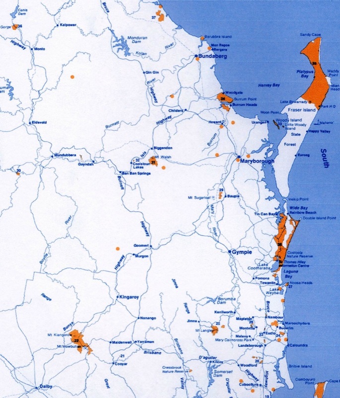
Firstly, apart from all that waffle, this funny looking thing here - I'm one of those dreaded Victorians who came up here to help take over the place, but at least I brought my money, I brought my family, I didn't have much money, but I brought everything I owned up here to live in Queensland. I was appointed to Gympie in 1978 mainly because of a promise the Director had made to the Gympie City Council. The regional headquarters was in Maryborough, but I was 2-I-C or District Ranger for the Maryborough District quite often known as the Gympie District - the terms were interchangible. But of interest here is this map. That basically was my territory. There were 35 National Parks in there from Bundaberg out to Monto, the Bunya Mountains, Glasshouse Mountains to Bribie Island. Anything to do with National Parks in that area helped give me grey hairs.
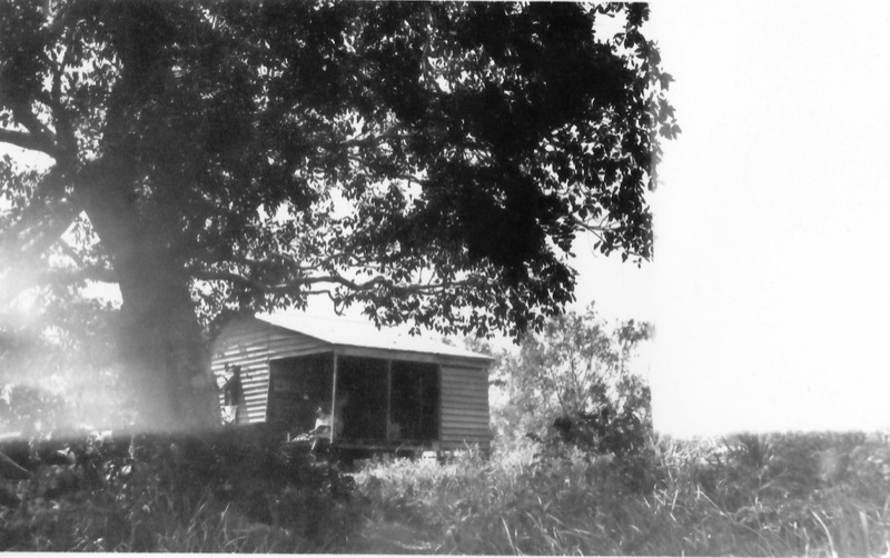
So the first job I had when I arrived in Gympie was to go down to Boreen Point and stay overnight and that was from Gympie. I just did what I was told, and helped to peg out the site of the new building. And I was sort of reminded of a couple of people, I well remember being a country lad from Victoria, I'd worked in the National Parks down there, but I put my overnight bag on the bed in the motel here and I was rather horrified to see the bed move. It moved that way and then it moved back, and I thought rats you know, I've been conned, there's Carpet Snakes. But they'd given me a water bed. Anyhow that was my recollection of Boreen Point, but that will explain why, partly explain why Cooloola didn't get the attention that it should of. There were other political things as well.
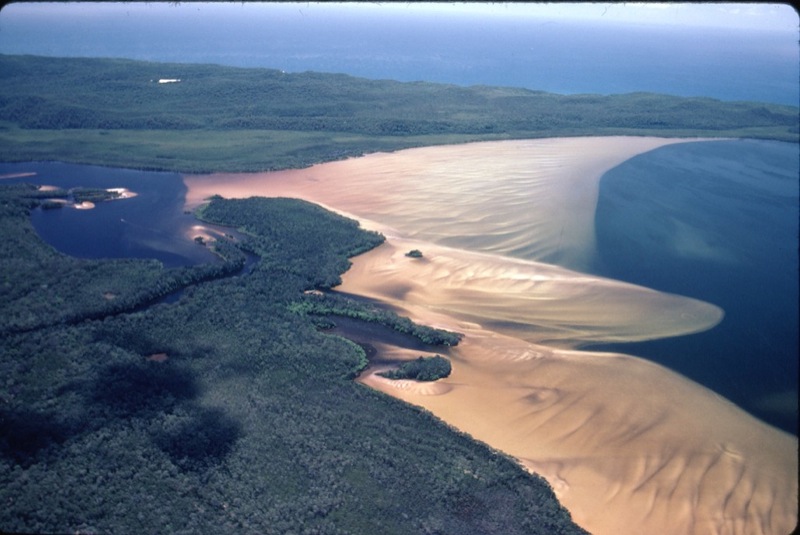
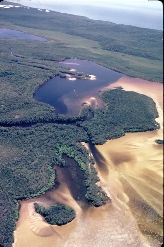
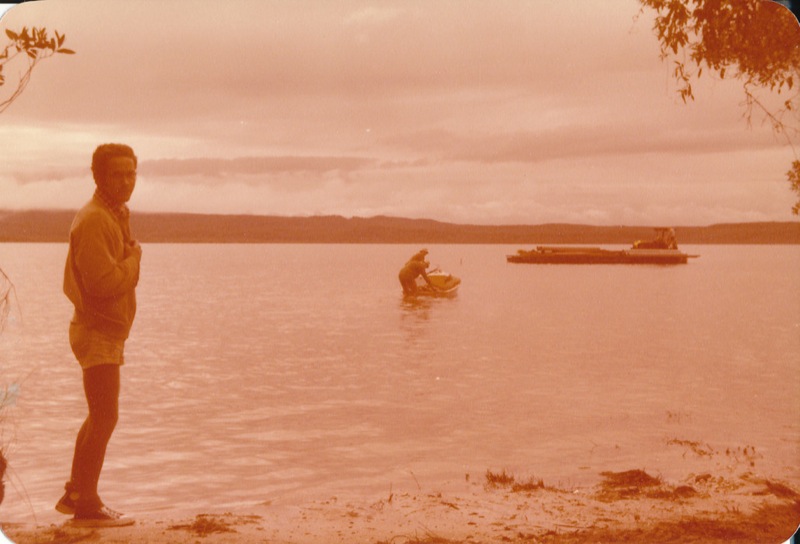
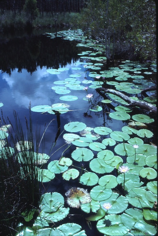
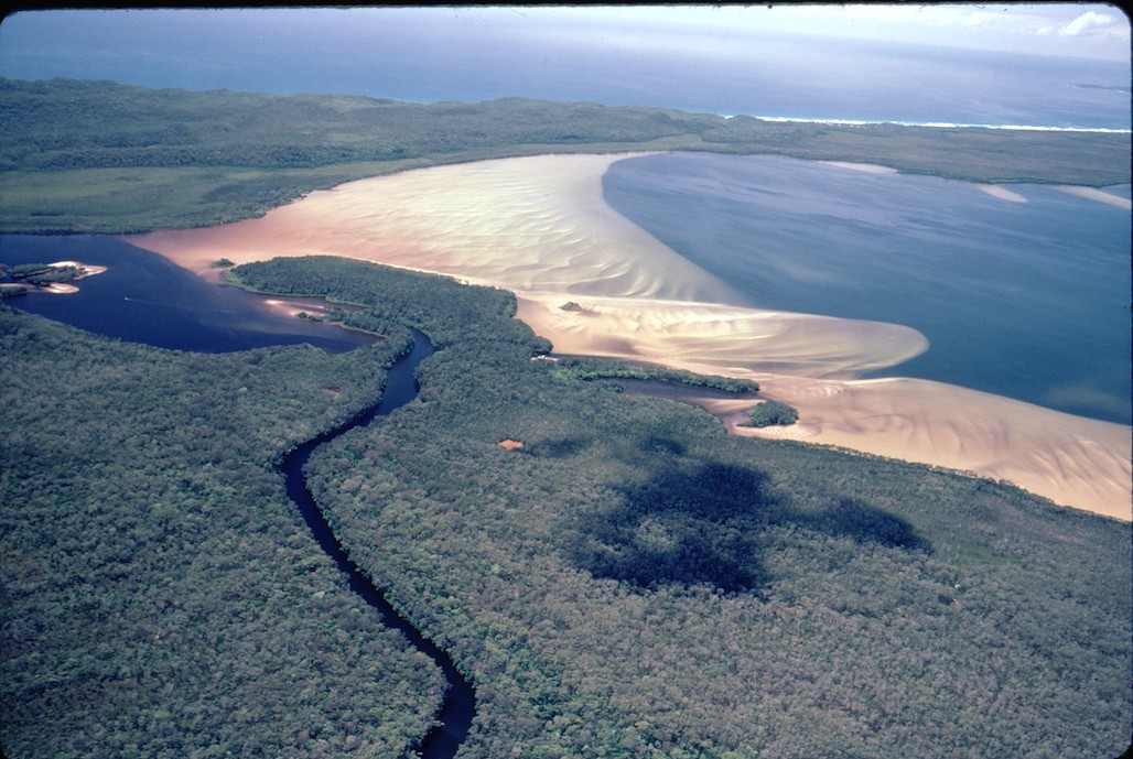
I'd like to first give you an overview, many of you would have seen this, but I am always fascinated by the sand fans that grow around the top of Lake Cootharaba, how the whole place is moving. This is a 1980 photo. I'm going to talk about the 1978 period, so just forget the Kinaba Information Centre is there please for a moment.
My first job was to come down here and help peg out the new building. I was made aware that it was a rather contravercial site because there were 2 factions within the Head Office, and one of those factions for which I was working, the Field Operations, felt very much that we needed to have control of the Southern Cooloola area. They argued we needed a control centre with an interpretative function. On the other hand we have another group who argued strongly that they wanted an interpretative function with a control secondary.
Now, Fig Tree Point was the site chosen by the alternative people who wanted to use the interperative centre. At times there are masses of birds there. I'll come back to that later. But I've recently been loaned a document which I gave to Elaine some time ago, and it was interesting to read a bit more of the history of the area. I'll just read part of that. “On the 24th November 1970 Sir Thomas Hiley wrote to the Premier's Department. He indicated that he and a number of friends had founded the Bird and Waterfowl Society of Queensland and the Society had raised a sum of money which they desired to be used to finance a project which would contribute to the preservation of birds whose continued existence was endangered, and to ensure that there would be opportunity for observation by future generations.” I think that's rather pertinent - the aims and objectives of the people who were putting up the money.
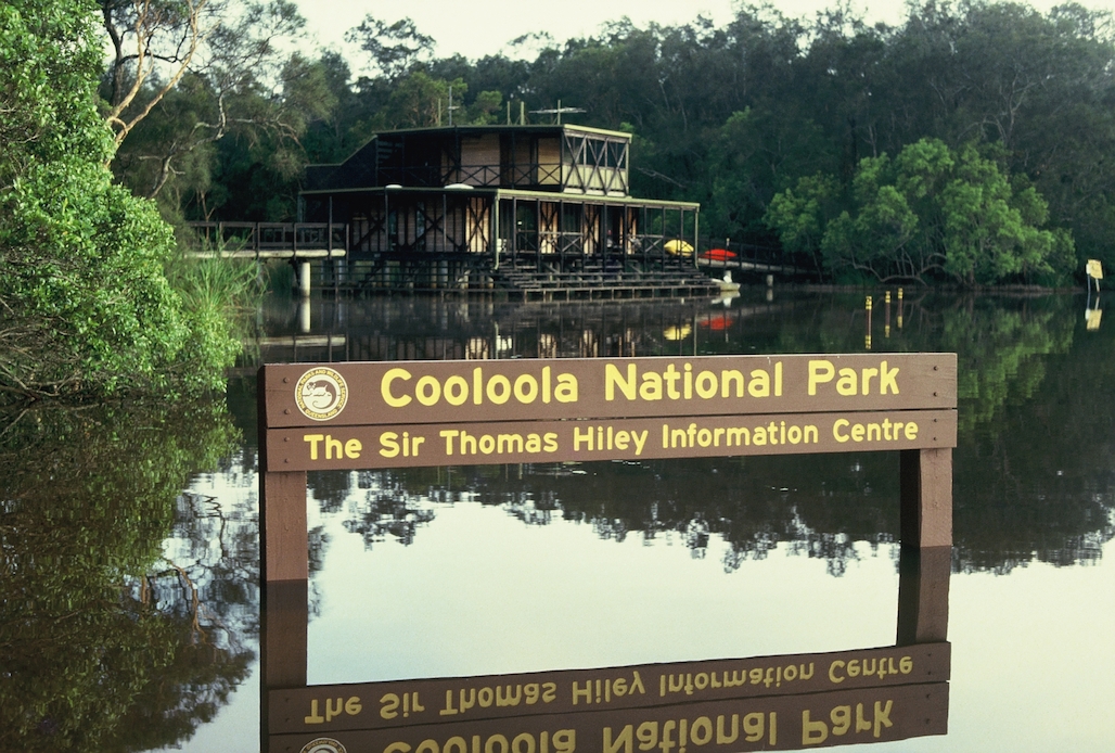
The people, the groups, Sir Thomas Hiley unfortunately perhaps, pointed out that there were 2 birds of interest - the Lyrebird and the Bellbird which they thought were endangered, and anyhow the correspondents went out to the Forestry Department who were responsible for the operations of National Parks at that time, and the Primary Industries who were responsible for the Fauna Reserve, much of which you can see at the top over there, wrote back to say those birds were not particularly endangered. So a search started around South-East Queensland for other Wetland sites. They zeroed in on Kippa Ring. That was all beaut and bonza and fine until someone decided it was a good place to build houses. So the attention turned to the Cooloola National Park area - that was right up the alley of Sir Thomas. He had a great affection and affinity for the area and Harry Spring, and no doubt quite a few others. I don't know. I've never seen a complete list of the members of this group, but anyhow, they put their money up and there's where the building is. You can see it there. That's the Sir Thomas Hiley Centre in 1980, a couple of years after it was opened. This created quite a few problems, not the least that there was 1 bedroom and we had a male and a female staff, and in 1978 that was a bit sort of dicey, to insist that these 2 share the one bedroom. Anyhow I didn't hear of any problems.
The other things that worried me greatly, and had been pointed out in this report, was that much of the land around there was not National Park. The Island, Kinaba Island was controlled by the Noosa Shire Council. There had been a nearly 5 acre lease granted on the far end, the eastern end, and there was a Rozema, a couple of people put up a little picnic development there, and that was bought out by Dianna and Noel Playford. And one of the things that was music to my ears in later years was when I discussed with Noel the future of his lease and he said we'll give that back to the National Park on condition that the whole Island become National Park. So that's how we got that Island. So credit to them.
The Peninsula there was shown on the early maps as being an island. It was not part of the National Park and we had put this jetty and walkway and our sewerage disposal on that area, and so there was another problem. The Islands, the other little islands, and the other thing I personally saw. I loved to canoe around through those shallows there, and all of a sudden I found I couldn't get through with my canoe. The area was changing that quickly. It was becoming silted, the plants were growing, the trees were growing, and there was a problem.
1971 saw a report of a, an inspection by the Gympie Chamber of Commerce, and they thought that was a really great area for commercial development. So there are people who look to that sort of thing. Now why the Rozemas picked that island there, the shallow water compared with the deep water, I do not know. But what I did anyhow - the first couple of staff, they departed the scene, they didn't like me I don't think, oh one of them did, but I found out I had a problem. When the tour boats were coming up, these two would disappear behind the back of the building, and they would make themselves not available. And I found out they were highly offended by tourists going into this area, and so I had to get a bit stroppy. Anyhow they departed the scene and the next chappie I had happened to have a theodolite and was a Surveyor. And so what we did, we took a theoretical boundary, desirable boundary, and got that surveyed properly with a theodolite. We took in all of the islands, and that was the concept. We were taking all of that, and as it changed it would be National Park.
I was interested to read this report to see there was a great deal of interest shown in the what was described as the Kin Kin/Como area for a major development, which accords with the interperative people, and they spoke in this report of the better area for sewerage disposal which you have along that ridge, which you don't have at the present building. It is a problem particularly when the water comes down. And there was I think also a discussion point about that area there, but that may well have been a great place to see bush birds. They listed 26 odd birds that they'd seen up there and the focus had switched away from water birds to bush birds. Anyhow, look, we have the Centre. It was a great and generous gift by far-sighted people who lived out their dreams.
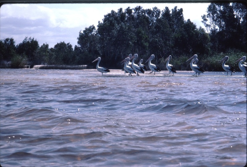
I think there..Now see here the type of thing why the interpretative people wanted Fig Tree Point, because you often get birds like this. It is quite spectacular. Now Dave Batt reminded me that in 1983 he counted 1 flock of some 600 Swans. There was an influx of Pygmy Geese, there were Whistling Ducks, I've heard of those, there were the Pelicans, there were the on and on and on, different sorts of water birds. Now I can pick up a few little things here. Look in the water. You might just pick up, there is a bit of floating weed. Now Dave and I have been wracking our brains and I can't remember, the name of that water weed, but it seemed to flourish after there had been a mass of fresh water coming down the river which pushed the salt water back. And Dave said at one stage there was a flock of Swans which went from Lucy's hole, the eastern end of Fig Tree Lake almost down to the Teewah Track landing. It was a mass of birds, and there was a dark plume of the fresh water from the Noosa River went down that side. So I think, I'm a little bit ambivilent, but I tend to think I like the idea of an interpretative centre.
We had no control in 1978, we have no control, Parks' people have no control now, little control now, not in the context that we had. But anyhow, I'm not going to turn the clock back and argue there, but you can see here, Kinaba Island at the back, and the full mud factor starts of islands and the start of vegetation.
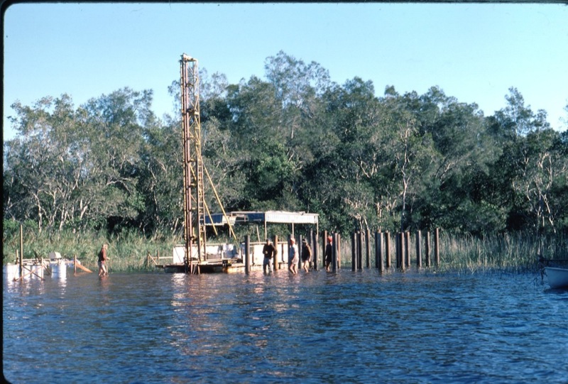
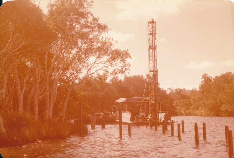
Now 1978. I'd been down there, I held one end of the tape - that's my claim to fame, that I helped peg out this site. There were at least 2 tenderers. I don't know the name of the people who missed out, they're consigned to obscurity I think. But Lindsay and Keith Robertson from Gympie were the successful tenderers. This is one of Barbara Thomas's photos. You can see the piles going in. The talk now about the way they went about doing this building.
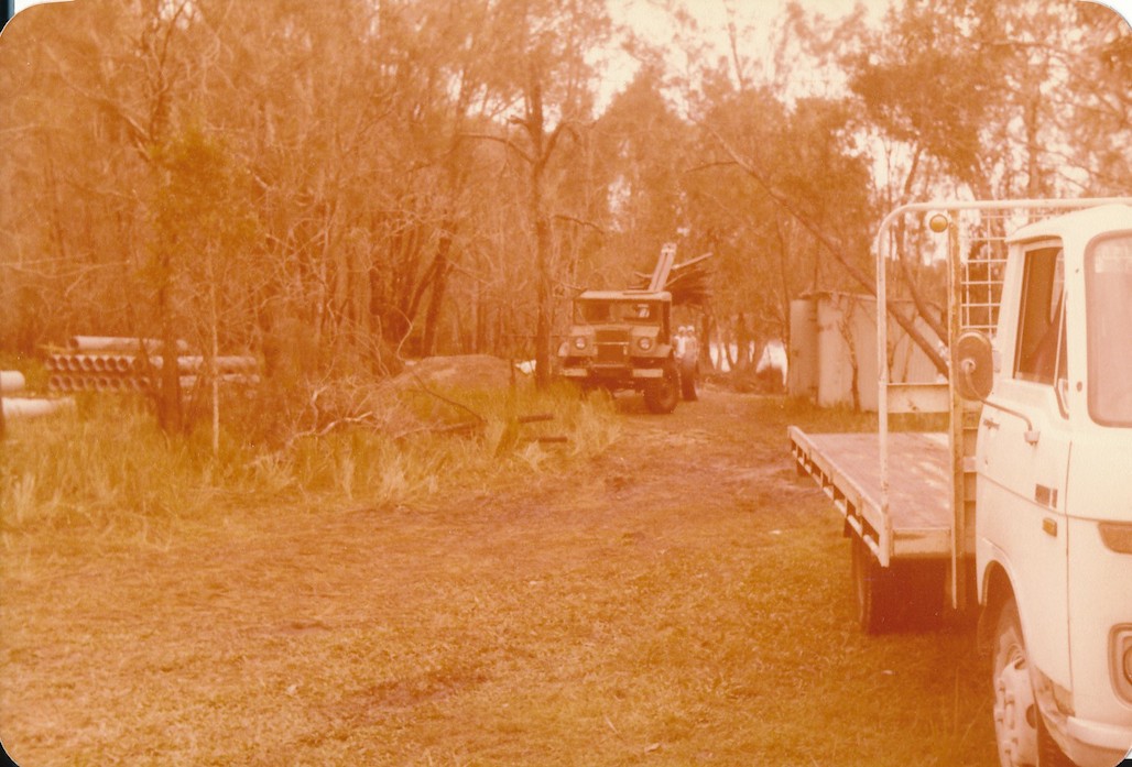
The Roberston brothers have a timber mill in Gympie and also in Brooweena, or they did, and they brought down their Blitz truck and they parked it at Mill Point. That became the base of operations. They drove from Gympie every day down to Mill Point with their materials and they operated from there.
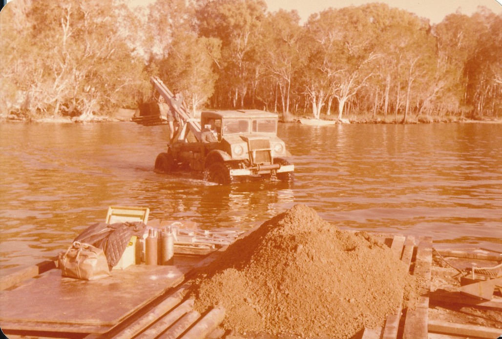
And here you see the use of the old army Blitz for lifting.
And how they did it. Now Keith Robertson told me he went down to Tewantin, he found a couple of pontoons, and they put a deck on these 2 pontoons, and they made themselves a barge. They got a couple of 150hp motors, and they were in business. But I'm told by one of the chappies who was there working, they often had to get out and push, the water was that shallow. But anyhow you can see here how the place was built.
And the barge out there. I'm told they had a visit from the Boating and Fisheries mob one time, and they hid one of their little boats because it wasn't registered, and the Boating and Fisheries looked this thing over and looked it up and down and probably knew what it was all about, and they disappeared over the horizon.
There's the jetty going up. That's our early Park boat the Darter with Tinbeerwah down in the back.
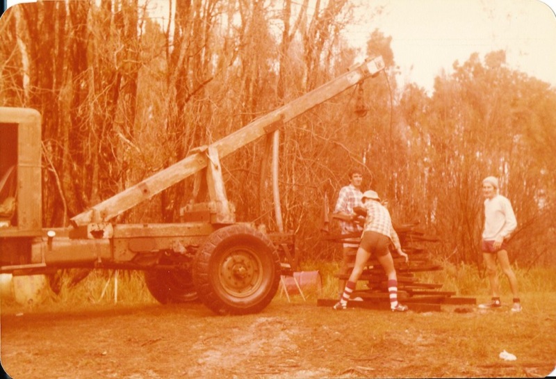
They made their own pile driver - resourceful people.
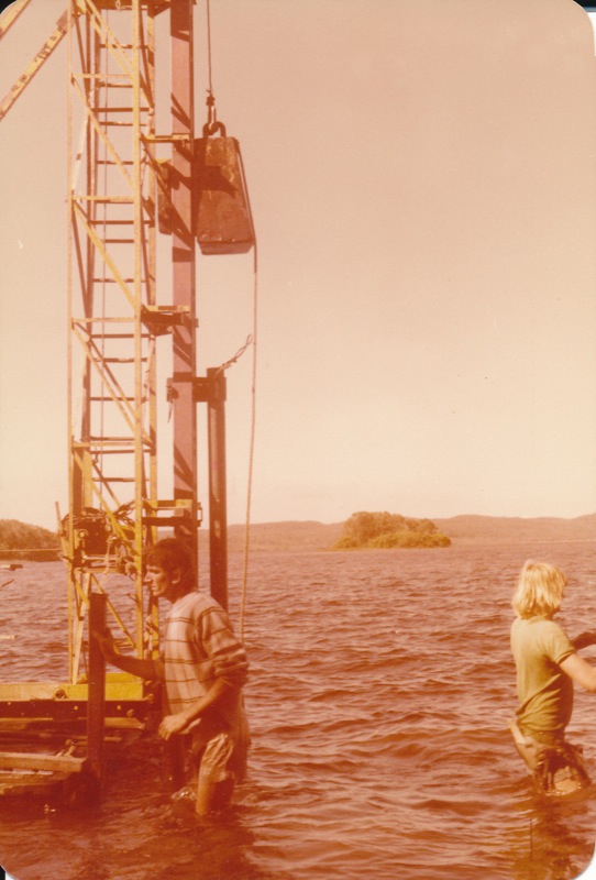
That's at the end of the jetty. There's your pile driver - a 500lb dolly, and they had steel, hollow steel pipes. They drove those down and found a firm footing at 4.2 metres.
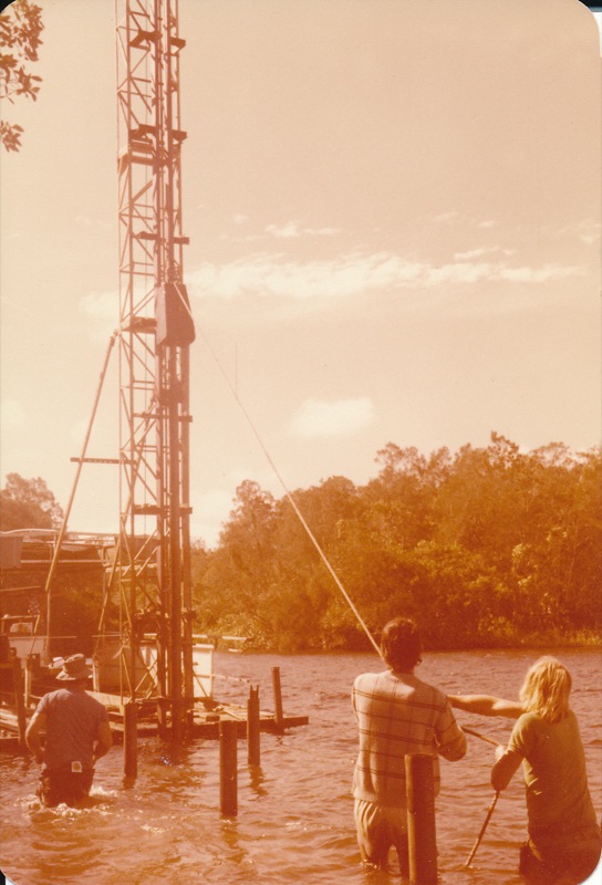
There we go. Now he wasn't sure why the 2 chaps are pulling on the rope. I suspect there must have been some problem with the dolly, the weight as it was going up - they just pulled it clear so it would go up. He said no trouble coming down, anyhow.
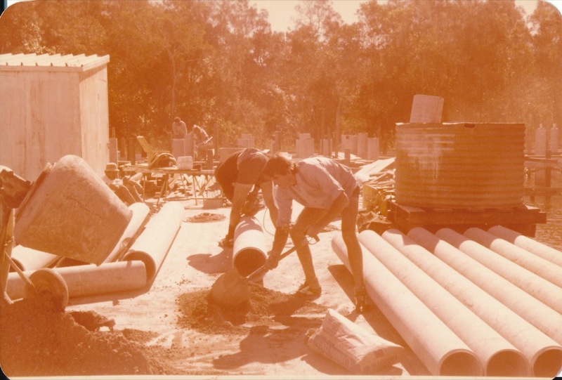
Now on the, they built themselves a deck sort of midway between the jetty and the building, and you can see there they are mixing cement. They used rather a dry mix of cement and I'll explain that why. But you can see the asbestos cement pipes.
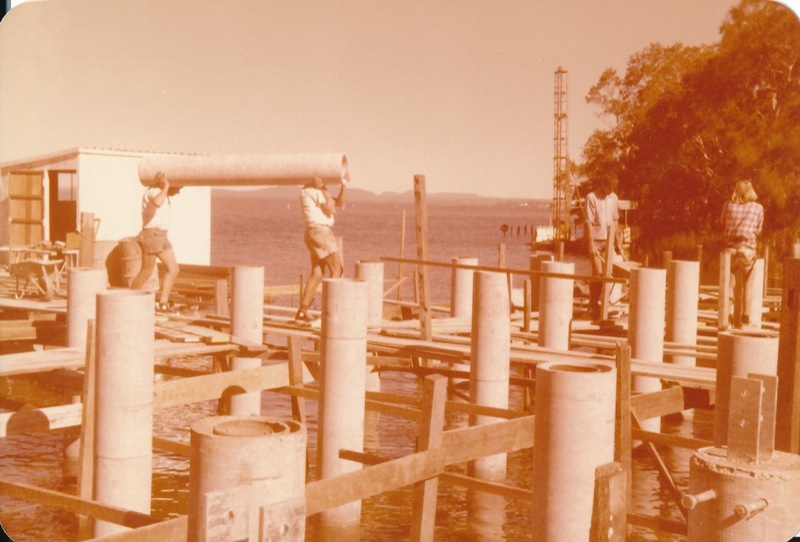
Now here, now here's where I have a problem. Because here we have the steel pipes inside the asbestos cement. So you can see the idea. They have driven the steel in, they've put the collar around the outside - that was done to exclude the salt water away from the steel. They then backfilled with a very dry mix of cement, and when that was all beaut and bonza they put a stirrup there on which the building goes up. So you can see the chappies carrying the pipe out.
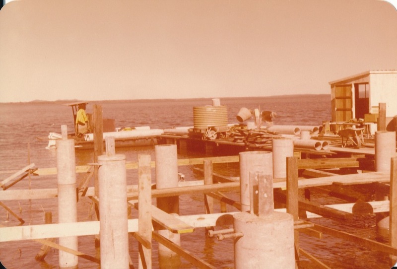
And there is another, you can just see a rather, an interesting and unique thing here. The work deck there - look underneath - they're 200 litre drums. They've taken the bungs out. They've backfilled them with water. They've built a platform over the top, and away they went. And for those who were there at the opening, I knew the big platform at the front of the building wasn't rock solid. But anyhow I was unaware because they had fancy paper all around the edge, but that whole platform of nearly 100 people, had 35 x 200 litre drums underneath full of water, and they put this decking over the top and some frilly paper around and that's how they did it. The alternative tenderer was going to operate from a Hotel in Tewantin and drive up the river every day.
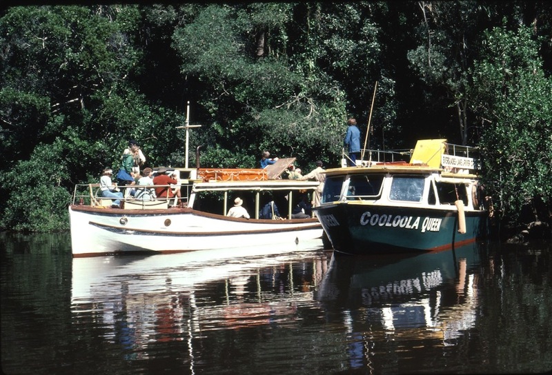
Now, come the big day, I love Kin Kin Creek and that's actually up Kin Kin Creek. But these are the early tour boats that operated in through the area. They were hired in September to bring invited guests up the river, and so this is how they came up.
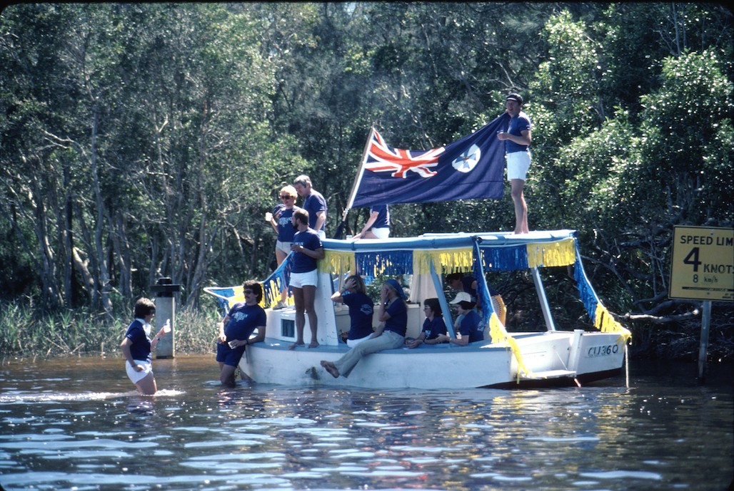
I'm not too sure about this. I'm still puzzled. When I look closely at the photo I suspect, mm, they might be Public Servants. Can you see how a couple of them are hiding their faces? I'm not sure. They're very patriotic. But anyhow they were there. And you can see the 4 knots speed limit.
And there we have the big moment. Now I was at the back of the crowd, and I had been tasked that day to bring the Director up and a couple of people. My boss Tom Ryan has a larger boat and he brought that down from Maryborough. And all the invited guests went up and they're all looking at this magnificent, strange building perched out over the water. All of a sudden we have Joh in front. There's Premier Joh and Harry Spring, and the whisper goes around this assembled group, “There's Joh. He must have walked on water to get here.” They knew he didn't come on the tour boats. Then I heard another whisper “He must have come down from the clouds.” But, there is is. Now I'm not sure of the lady in blue. I was with Pilot Beryl Young one day but I just don't recall. I'm pretty sure that's Joh's wife. Sir Thomas Hiley in the checked shirt. The one, the man under the white hat I'm not sure, perhaps Gordon Simpson, I just forget, and then at the rear left is Dr Graham Saunders, the Director of National Parks and his wife. So there's the big day, the big opening, and Joh walked on water to get there. He came across on the boat with I think 6 bodyguards. So he was a bit concerned about his safety. Other than life jackets that we had in the boat, but don't worry about that.
Now this is the day that's special. There you have it in all its glory. The question about why it came to be known as the Kinaba Information Centre, I think it was because of a period of lack of money, and these boards are Crows Ash, they're not cheap, and I think we probably opted for Kinaba Information Centre as being a cheaper way of making a sign, I think. Anyhow, there it is. It's one of the loveliest photos I have seen of the area.
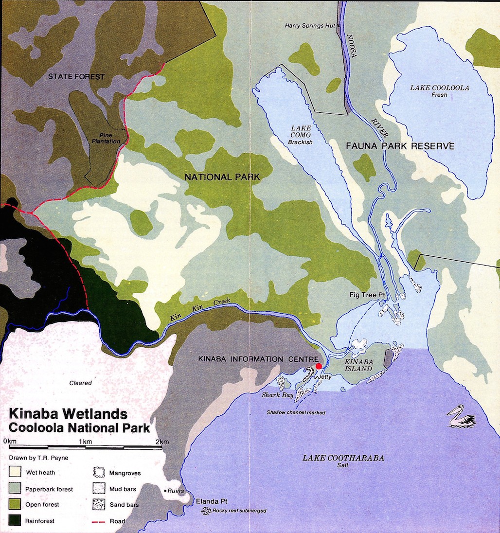
The first official map of the area showing more the vegetation, and because a lot of people were getting lost going up the river, we've dotted in the line showing how to get up the river. The Noosa River, Harry's Hut was always the focus. That was where you went. But to me, Kin Kin has its own special charm, and I really tried hard one time to interest, I did interest a Senator from Tasmania, and he invested his money and he built a boat to run up Kin Kin, but it turned out to be a bit of a lemon, and I'm not too sure whether he went back to Tasmania or whatever. I had the feeling they didn't do a lot of work down there. Eastern end of Kinaba Island on the right hand side you can see the special lease that was granted to the Gale and Rozema I think it was.
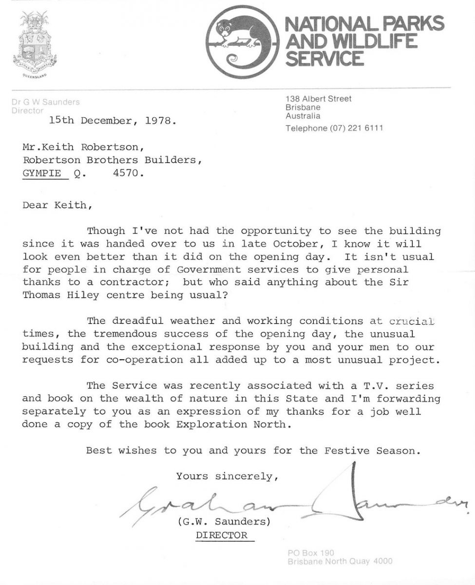
Now I just like to put that up. We had a very nice Director if you can read that - for those at the back who may not be able “Although I've not had the opportunity to see the building since it was handed over in late October, I know it will look even better than it did on the opening day. It isn't usual for people in charge of government services to give personal something to contractors,” but anyhow look I'm having trouble too with this oblique angle. That to me signified the type of man our Director was. And if you want to know one of the reasons why Kinaba started its demise, it was the death of that man. There was a lot of other bureaucrats who saw their way to the top. There were officers went everywhere, buildings went up and money became short. But anyway don't get me going. He was a really nice man.
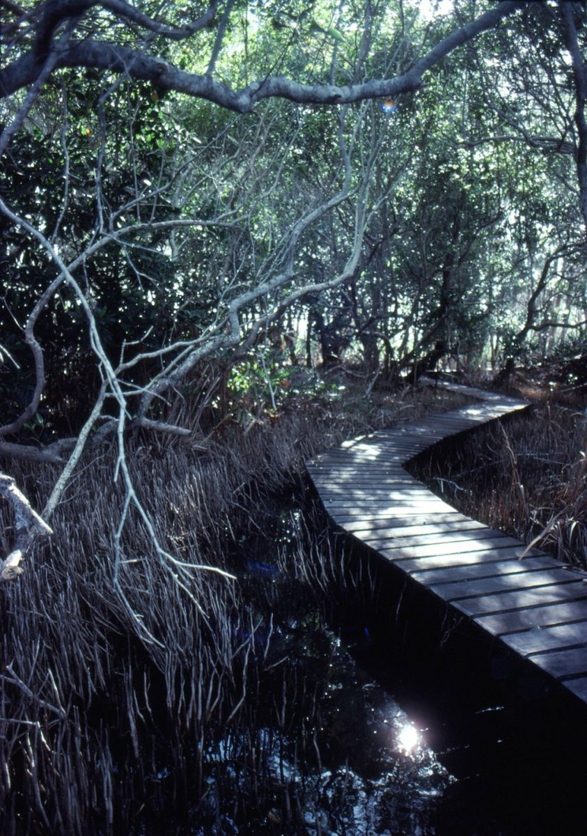
Now one of the areas that we didn't control, I went back to Sir Thomas and said are you interested in bird hides and walks through the Mangroves, and he was very much interested, and I well remember him saying he had some money left over from the building, so he granted us the money to build this. Now this building had attracted a lot of attention. There was a South Pacific Forum on National Parks held in Brisbane, and the first thing I know is they are coming up to Kinaba, and here we have, we've got these stumps in, we've got loose planks, and these people insisted on coming out to have a look. I thought Oh my God! The mud they'll smell is pretty awful because we were working in it, but anyhow we put loose planks along there, made it as safe as we could, and the South Pacific Forum - they duly departed without anyone getting too wet. The King of Tonga enjoyed the place, yeah, and I took him up the river too, and I made a royal loo for him.
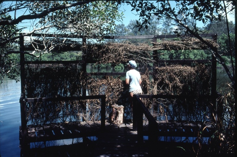
And the bird hide, if you go to the bird hide, sometimes you see birds.
And when you get the water fresher than more brackish, you will get this as I guess many of you will know. One thing which tends to be sadly lacking is the wealth of birds, which is a bit sad when you look at the original concept.
Just to throw a few other little things in here now, that's the jetty at Fig Tree Point being built. I got away with some Turpentine logs when Forestry were clearing the Como Forestry. And there it is. That was finished in '84.
And Elaine mentioned earlier how in 1874 a map showed the original Noosa River going down there. Elaine also mentioned, see the little arrow-shaped Lake on the bottom left, that's where the chappy took his bee-hives in, the fishermen were going in, the slope on the left has a stand of Ironbark Trees. Now when you stop and think, this is all swamp country. Ironbark Trees, it really threw me, but I found them, and that's that. Now you can see here also Elaine was talking about, there is the description, or the photo Graham's description as to how he came from the rocks at the beach across to, he waded through the water and got a lift over the river.
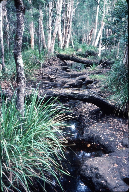
One of Barbara's photos, one of the things that saddens me now is that I've lived as a Park Ranger for pretty well all my married life, and time and time and time again people tell me one of the best things about there being a Park Ranger there, is that you can find someone to go and talk to. If you've got a complaint you can ask questions, but there is a presence. I won't say too much about the current thing, but Lake Cooloola concerned myself, Dave Batt who was really into outdoor education, you can see the water level is down a bit. You can also see some of the water around the edge of it, it is a terrible place to try and get into. And if you don't have experience please don't go in the heat. There's been stories of people swimming incoherently down the river after blundering through that sort of stuff. But one of the things where Friends of Kinaba group should be able to give advice if people want to go to Lake Cooloola. Tell them “get lost, go anywhere, don't go there” because it is Tiger country. And unless you're experienced and got a lot of water it is very, very difficult. We have lots of stories about people floundering around in those swamps. It's not pleasant. Up to 1988 the Noosa Coast Guard was still putting out a map showing the track “the track” into Lake Cooloola which was in The Narrows.
So there we are back to Kinaba. One of the other things you can see are a couple of little sand islands dotting out there. An early job '79-'80 was to go and negotiate with the professional fishermen at Tewantin, and to ask them to please stop netting around the shallows there as it was disturbing the birds, and they were quite good, after a few meetings, and I went and pegged out and surveyed areas around those shallow areas, and they as far as I know, they kept away from those shallow areas. But then events moved on. There had been a report put out on the Bass, and their need to migrate down, and the netting boundary was moved down there a little bit, down South. See here again the sand fans that are coming out around that side. You can see some of that darker water over there that Dave Batt spoke about, it went right down to near the Teewah Track, there was this great mass og Swans. Quite a few of the early visitors to the area told me of being able to go around the Fig Tree Lake collecting down. They would make pillows, rough blankets, sleeping bags out of it. I'll come back to that point.
The old boats were a little bit slow. Faster, quicker boats came in, and we started to be hit with an explosion of numbers. There was a race on to go up the river to get the reflections first. It took about 1/2 an hour for all the froth and bubble to dissipate, but the tourist operators would not listen to our side of things to please space it out. Any of that is just part of the history of the area. Yes.
A couple of little final points. Just look at that, see there are a couple of bollards you can tie up to. Our sign there used to get flattened on a regular basis. We had trouble getting it right down deep. And every time there was a decent flood it would disappear and we'd scrounge around. I think sometimes we lost it and had to make another one, but just notice those couple of posts.

And you can see those 2 posts again. I think many of you would have seen a flood coming down the river. There is danger, up in particularly The Narrows with floating logs and currents and things.
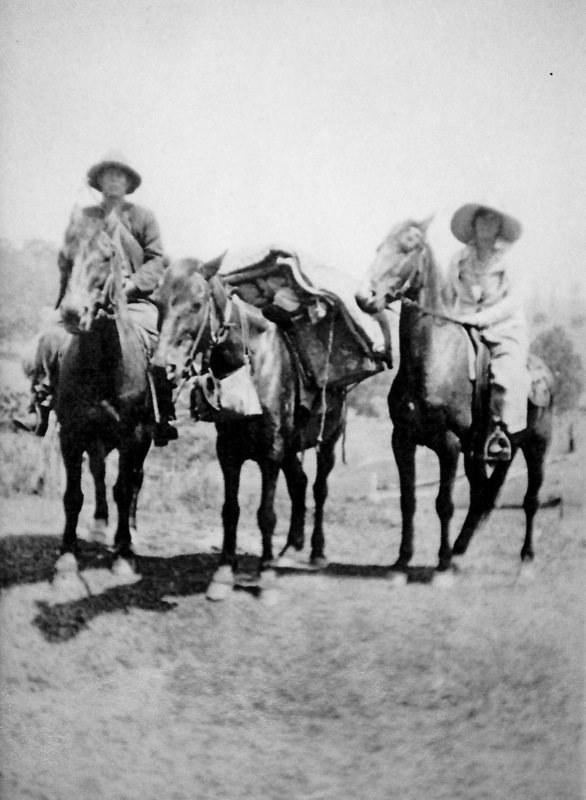
Mention about the history, this is the Salmon family, Richard and Linda. They lived on Wolvi Mountain. They drove down to the area on horseback. They collected their down. They lived on fish and the birdlife there. They built a boat at Wolvi. They dragged it down behind a bullock team, on and on and on.
And those who wonder why you've got the name Fig Tree Point, there is the Fig Tree at Fig Tree Point, and the Salmon's hut.
And Elaine mentioned, and I think I might have heard a little bit of disbelief, but they were, some of the farmers who tried to farm the coastal area of Cooloola, even Elaine dug up an account for me which made me shake my head, the earlier graziers grazed sheep in that country. Cattle were common enough, in fact right up until about the early '70s. And here you have an attempt, it wouldn't be quite like copying Tronson's Drain, but I'm told that is one of the attempts at draining the swamps behind Harry's Hut. Now when you drive into Harry's Hut next time, you go over a little bridge, just to stop and have a look. And I don't think I'd like to kick my way through there, but part of the history of the area. It is rich in history.
That's about all I have to say. Now I will have trouble in hearing questions, so if someone can shout at me, if you have any questions.
- Q: Kinaba the name, where does that come from? It was a name that was there, Kinaba Island, when I got there. Elaine please, the name?
- A: Elaine: Place of Ants. Ron: There you go - Place of Ants.
- Q: There are some pictures already after the sawmill is finished up there. A family lived and farmed that area in a house, and we've seen a few photographs, I don't know exactly where, but that must have been an extremely marginal place to stay.
- A: I don't know if they lived there full time. That Salmon family, they had a 99 year lease on Fig Tree Point, and they used it as a holiday, everyone used it, it was never locked, there are various people who have told me over the years, they went there, they lived there. One who comes to mind is an Ailsa Schwenke who said she spent her honeymoon there, war time era. She also told me of the 2 aboriginal tracks that were going north from Fig Tree Point, which is shown on one of the early map too. You're not confusing with Harry's Hut, that's nothing to do with farming. Elaine: It will be Jim Salmon's one,….. Whetto's Hut, you know Jim Salmon, he had the one behind Harry's Hut. He had a farm. Ron: Did they ever live there? Elaine: I think so. Ron: Did they. Sorry, there you go, I stand corrected. Elaine:Remember we found the posts in the yard? Ron: Yeah the posts and fences and that are there, so we make a good team. If I can't answer something, I'll ask Elaine.
- Q: Ron it's a funny topic, but I was one of the early people up there before the demise of bush camping with my family up there from the early '70s and saw the National Park come in, you did that very well. I was interested when they put the first composting toilet in there at Campsite 3. Was that a precedence for a National Park, or was there any difficulty in getting approval for a composting toilet?
- A: There is quite an interesting chapter I have written in a manuscript that I have got going at the moment about the development around there, and one has to do with the siting of the toilet at Fig Tree Point. Whether it was going to be a septic or whether it was going to be an alternative toilet. Clivus Multrum were not accepted at that time by Queensland Health, but we were not strictly bound by their regulations, and anyhow, the situation that developed was that the first ever Clivus Multrum toilet in Queensland National Parks was built at Fig Tree Point. And then we put a smaller version of those up the River.
- Q: Is there a story like during the Depression out of Cooloola Creek, the top end of the Lake there was a hobo living there because people were so disenfranchised financially, and it's up on the hill there?
- A: I'm going to yell help. Elaine: I hadn't heard that story. Ron: No I haven't. Elaine: It wouldn't have been the Ironbark site. Ron: Well there is Ironbark there. It is dry. There's certainly signs of whitemen being there. We know that the fishermen were there. They were after the bark to get the tannin to stain their white cotton nets to help their fishing, but elsewhere, I wouldn't like to think of living anywhere in there. Yet one thing I did forget to mention there, a little to the south of there I was told that there was an aboriginal Bora Ring, so whether it is part, whether it exists or not, I don't know. I didn't really determine that. So sorry, no, I don't know of anyone living up there.
- Q: When the early tours' boats were up there, how shallow draft were they to be able to get into those areas? Did they struggle to get in and out of those areas?
- A: They did struggle sometimes. I often heard of tourists having to get out and push going through, just to get to that Kinaba area. But the latter boat you saw, they were a lighter boat which floated higher rather than a deep hull, which is one of the reasons the old deep hull, displacement hull boats, they just weren't up to it. And of course they were too slow. They would only make 1 trip. That yellow boat you saw, they would make 2 trips a day. Planing hulls, yes.
- Q: Can I ask a question? I am concerned about the, and I ask the legal implications if there are any, where someone who has donated an enormous amount of money and has this place named after him, that a group of individuals can make a change of name. What's that legal implications of that person's situation, and can you just be wiped off the map?
- A: Well, I'm not a legal eagle, but may I just refer back to, I'm a little vague, but I have photos of the building with a sign there “Kinaba Information Centre”. That was done in my era, so you're looking at the '78 to '90 era. Whether you are implying it was anything to do with Friends of Kinaba, no, that was my era, and I suspect it was to do with a shortage of funds. Our Department lurched every year from shortage of funds. We would get told on quite a regular basis, especially after our old Director died “stop everything, take the keys off the men, there is no money for toilet paper”. This sort of thing, and it was lurching from crisis to crisis, and I suspect that is the reason why we put in the cheaper version of Kinaba. It was more commonly known as Kinaba, but blame me, don't blame anyone else.
- Q: I was really interested if you could help answer the question in reference to the fact that it was named originally as the Sir Thomas Hiley, so how did it lose Sir Thomas Hiley because his name was put on a plaque, and his donation and that history is being lost? Could you say something about that please Doctor?
- A: Elaine: Well, I think it's just time. It was still called the Sir Thomas Hiley Information Centre, only orally, and as time went by it was forgotten. Sir Thomas Hiley was the Treasurer of Queensland, and he was a man of integrity with a very good reputation. He just was generous. He gave to the community. He is also not the sort of person who would have worried too much, because it had been named after him. He died in 1990, and he lived in Tewantin. No it's not long ago. Charlie: Can I just come in there? There is a plaque in the building above the office window with Sir Thomas Hiley's name there in full view still to see. Ron: I think from my point of view all I can say is I believe that's what happened, shortage of money, it was easier to put Kinaba, and blame us for that. It probably again my lazy Australian way - why say Sir Thomas Hiley Information Centre if you get the same message across with Kinaba. It might be an injustice to Sir Thomas. I found him personally to be a very nice person. I went back to him and here's some more money. But anyhow, I'm going to leave that for the future.
- Q: I was just going to ask you do you know who designed the building, and was there any public input into it?
- A: No, look I don't know. That was all done before I got there. The arguing, the resolution, all that had been done. But when I was seeking a bit of information for what I'm currently writing, I got in contact with the archives and there are a couple of folders relating to that area, so you may well find…In fact, I've got the details there with me in case someone did ask for more information, but no, I don't recall. I do recall there was Harry from, he was the Work's Superintendent from Maryborough, and he used to come down to supervise the building.(from audience) Actually it was designed by someone called Phil Carter who worked with the Works Department. It was a special project for the Works Department, and Phil Carter did a lot of work for National Parks. It was designed in-house which was unusual. Normally Works Department had buildings allocated to private practice, and they acted as Consultants, but this one had something special about it to be designed in-house by Phil Carter who I think has just retired, but he was associated with the National Parks' work. Ron: Thank you, you have saved my bacon.
Ken: Thank you Ron. That's it apart from these guys might be around for a little while. I thoroughly enjoyed that, and I think that input from the floor was really good. I think we all learned something from it, I certainly have, and I'd just like you to thank these, and the Publican and everybody here please in the usual way. Thank you.
